By Road
Altitude: Sainte-Foy (downtown) : 1051 m - Ski resort : 1550-2620 m - Chalet 1600 m. GPS Coord: N45,5903 E06,8999
Paris 640 km, Lyon 220 km, Chambéry 129 km, Geneva 150 km.
 Take the highway A 43 up to Albertville
Follow the express road until Moutiers , and then the RN 90 until Bourg-Saint-Maurice. Passing Bourg Saint Maurice, leave the supermarkets on your right, take the RD 902, and follow the signs for "Tignes - Val d'Isère" , pass Seez, and Sainte-Foy
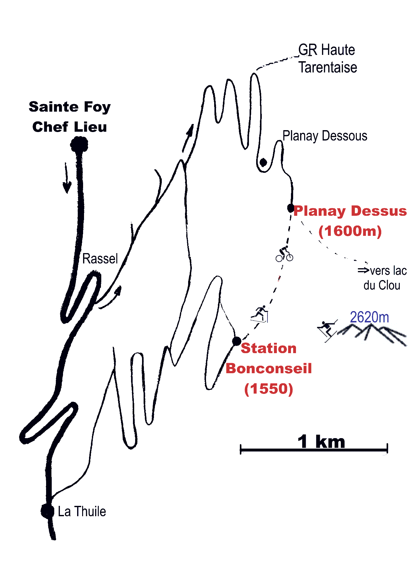
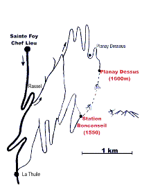
| From Sainte-Foy (downtown) to Planay Dessus:
Pass two hear pin bends, and you will see a warehouse on your left. 100m further, take the first road on the left.
(In winter, this is the place where you should consider using snow tires or other chains !)
Drive up about 6 kilometres following the indication "Le Planay"
At the end of the road, leave your car in the car park, and go into the hamlet by foot (50metres). Take the first street on the left, and then go up to the third chalet.
|
To zoom, -->click here
|
Updated info about trafic and snow on the road , contact "Info Route Savoie": Tel +33 4 79 37 73 37.
or savoie-route.fr
top
homepage
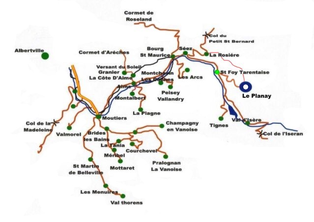 Take the highway A 43 up to Albertville